


Description
Overview
- Allows unique and versatile presentations via a web browser. Includes project management plus optionally QC, GPS and AIS data allowing 24/7 vessel tracking.
- Data is available in kml format, allowing utilization of the power of Google Earth to display vessel track, local AIS data, pre-plots, progress etc.
- The field data is encrypted and synchronised (updates only minimising data transfer) with a server ashore which allows access only to authorized users.
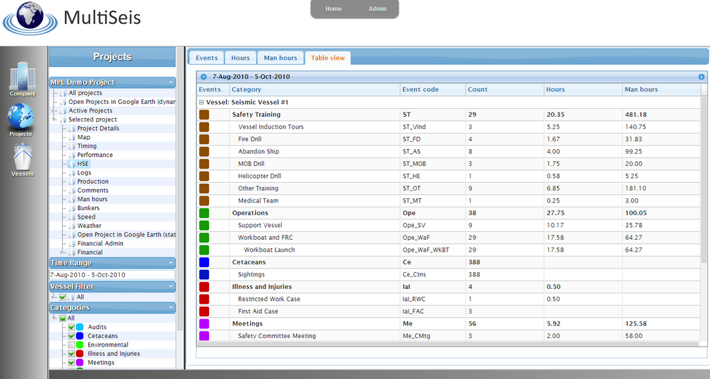
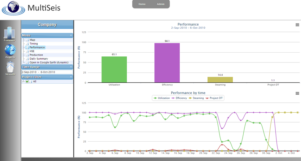
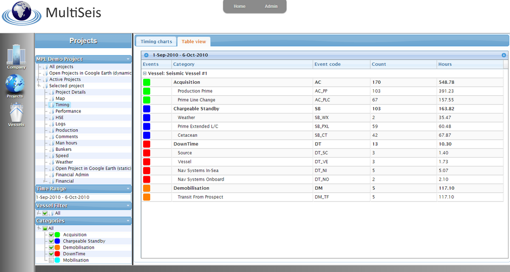
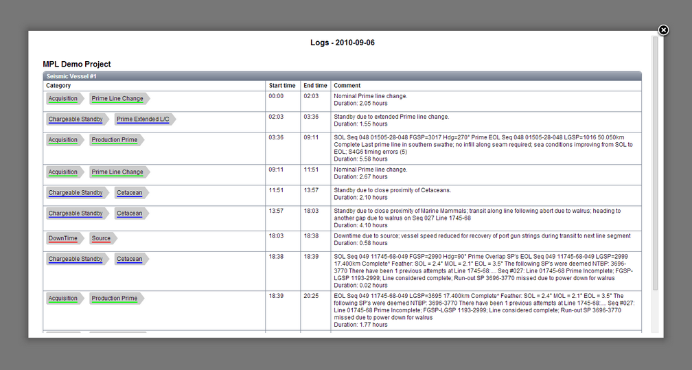
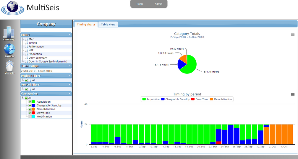
- Timing, Production, HSE (events, man hours, fuel usage), weather, feather, vessel speed etc data are available for interactive analysis and comparison.
- Data is active on the Global Manager within minutes of input. Both real-time and legacy data can be presented, enabling project monitoring from many perspectives (individual, vessel and company for any period).
- ‘Tour’ utility available for Google Earth, displaying each active project in turn (designed for large screen displays).