Trimble Business Center – HCE 4.11
$ 150.00
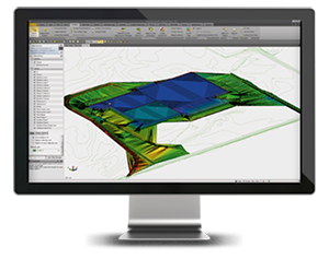
Powerful tools help you create accurate, integrated 3D models for sites, highways and marine applications quickly and easily. Make better decisions, decrease costly mistakes, and increase efficiency in the office and on the job site.
Description
Reduce Drive Time
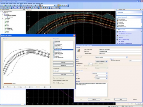
- Effectively and seamlessly manage data between the office, Trimble SCS900 Site Controller Software and Trimble machine control technology.
Reduce Rework
- Select, create, edit and draft data, as well as generate reports and plots, or publish information.
- Ensure data is clean, up-to-date and delivered in the right format to get the job done.
Win More Bids
- Prepare site earthworks and construction material quantity takeoffs quickly and accurately with expanded detail.
- Convert digital CAD cross-sections, rapidly extract cross-section information from Adobe PDF vector files and quickly see locations and quantities of materials for road takeoff.
Increase Profit
- Optimize site and corridor earthworks
Civil Construction Applications
Field Data Management
 Managing your field data has never been easier with Business Center – HCE. Designed to enable a seamless flow of information, Business Center – HCE includes these features:
- Supports most digital data imports and exports
- Supports Trimble SCS900 Site Controller Software, Trimble GCS900 and Cat® AccuGrade™ Grade Control Systems, and Trimble PCS900 Paving Control System
- Seamlessly transfer data to VisionLink for fast and easy project monitoring, analysis and reporting
- Create road and rail corridor models
- Create and process data
- View data in plan, profile, cross-section, 3D and spreadsheet
- Manipulate point cloud data quickly and easily.
Data Review
Enhanced tools for Site Data Managers and GPS Managers give you the ability to select, create, edit and draft data, as well as generate reports and plots or publish information.
- Select, create, edit and draft data
- Generate reports and plots
- Publish information
Data Prep
 Efficient construction operations begin with accurate data preparation. Business Center – HCE helps ensure data is clean, up-to-date and delivered in the right format to get the job done.
- Import and clean up CAD data
- Use CAD tools to trim, extend and offset lines
- Elevate contours, pads, lines and points with automated, high productivity elevating tools
- Create an earthworks model for grading
- Create a drill plan or tunnel model
- Use advanced surface modeling and editing tools for site projects
- Import raster image files in many formats or Adobe PDF vector files
- Rapidly extract line work data from Adobe PDF vector files
Site Takeoff
 Prepare earthworks and construction material quantity takeoffs quickly with expanded detail and sharper accuracy — helping you win more business. Site takeoff is available in three different modules with varying levels of functionality to suit all your needs.
- Takeoff – full-featured takeoff application
- Takeoff Intermediate – areas, lengths and counts of materials, including finished grades and subgrades
- Takeoff Basic – areas, lengths and counts
Use Business Center – HCE for site takeoff to:
- Create a materials and site improvements library
- Perform heads up digitizing from raster images or digitize from paper plans
- View multiple images with edge matching functionality
- Assign site improvements, topsoil stripping and replacement areas
- Use drillhole data to build subsurface strata models and associated volumes
- Account for overexcavation and create of Areas of Interest
- Create takeoff reports that include all material volumes lengths and counts, and cost information
- Balance site earthworks
- Estimate drilling and piling costs
- Define haul zones, haul roads and hauling costs
- Compute borrow and waste requirements
- Assign haul and material costs for earthworks bidding
- Compute mass haul for the site
- Import raster image files in many formats or Adobe PDF vector files
- Rapidly extract line work data from Adobe PDF vector files
Road Takeoff
 Business Center – HCE for road takeoff gives you the ability to convert digital CAD cross-sections, rapidly extract cross-section information from Adobe PDF vector files and quickly see locations and quantities of materials. Save time, reduce rework and increase bidding accuracy with road takeoff from Business Center — HCE.
- Digitize cross-section drawings from a raster image or a vector PDF file
- Convert cross-sections into a 3D model automatically
- Store cross-section objects in association with an alignment object
- Map original ground, finished design and multiple material layers (subgrades) to stored cross-sections distinguished by layer
- Easily extract required surface from complex CAD cross-sections
- Generate average end area earthwork reports
- Import raster image files in many formats or Adobe PDF vector files
- Rapidly extract line work data from Adobe PDF vector files
- Perform comprehensive mass haul analysis
- Find the best borrow and waste sites to use for the lowest cost
- See graphical representations and geographic location of borrow pits, waste sites and haul roads
- Place barriers to mass haul along the alignment and optimize to haul around barriers
- Assign import or export locations with cost analysis and volumes
- Define multiple haul ranges and balance haul at stations
- Create mass haul diagrams with multiple charts to see mass haul and instantaneous cuts and fills in relation to the design profile
- Enter multiple tunnels on a single alignment with multiple layers for each tunnel
- Expand tunnel design for drilling and blasting
- Build a tunnel model and export to SCS900
- Create a tunnel surface model from point cloud data
Marine Applications
Marine Construction
 Trimble’s Business Center — HCE office software is ideal for many marine applications including:
- Hydrographic surveying
- Dredging surveys and volumes
- Large multi-beam data set management
- Marine and land construction design
Be more profitable, work more efficiently and reduce rework with Business Center – HCE.
- Manage marine point cloud data to check for errors in the data set
- View models in 3D to check validity of marine and land topography
- Import data from third-party marine acquisition packages
- Merge terrestrial and hydrographic data to manage the surf zone
- Plot color coded waterway bed contours and cross sections
- Input simple or complex channel designs
- Evaluate different channel or breakwater alignments to quickly find the ideal design
- Determine volumes prior to dredging and then report progress volumes
- Use positive depths or positive elevations
- Add optional modules as work tasks evolve
Business Center – HCE Hardware Requirements
Business Center – HCE has the same system requirements as other state-of-the-art CAD systems. Although it will run on many minimum category systems with small data files, performance will quickly become unacceptable as the amount of data increases.
Entry level
- Intel i5 or i7 Processor or equal speed AMD brand
- DirectX Graphics Card
- 512MB Graphics Memory
- 1280×1024 Display
- 4GB RAM
- 300GB Hard Drive
- Windows 7 or later – 64 Bit
Recommended
- Intel 7th or 8th generation i7 Processor or equal speed AMD brand
- DirectX Graphics Card
- 4GB Graphics Memory
- 1920×1080 Display
- 16GB RAM
- 1TB SSD Hard Drive
- Windows 7 or later – 64 Bit


