


STAR*NET v14.0.2.9137 Ultimate specialized surveying software by MicroSurvey
160 $
MicroSurvey STAR*NET 14 is the latest generation of professional survey network adjustment software designed for engineers, land surveyors, and geospatial specialists who demand maximum accuracy and reliability. Powered by advanced least squares adjustment technology, STAR*NET 14 delivers precise 2D and 3D network computations, ensuring statistically sound results for control networks, GNSS surveys, and construction projects.
This powerful version introduces enhanced performance, faster processing of large datasets, and improved automation tools, including command-line batch adjustments for streamlined workflows. With support for total station, GPS/GNSS, and leveling data, STAR*NET 14 integrates multiple data sources into a single, optimized solution while providing detailed error analysis, residual reports, and quality control diagnostics.
Ideal for high-precision surveying projects, MicroSurvey STAR*NET 14 offers unmatched flexibility, robust data validation, and industry-proven reliability—making it an essential tool for professionals seeking accurate, defensible, and efficient survey results…
Description
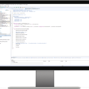
🚀 MicroSurvey STAR*NET 14.0.2.9137 – Ultimate Survey Network Adjustment Software for Precision & Performance
MicroSurvey STAR*NET 14.0.2.9137 is the latest high-performance release of the globally trusted survey network adjustment software, engineered for professional surveyors, geodesists, and civil engineers who require maximum accuracy, reliability, and efficiency. Built on powerful least squares adjustment algorithms, STAR*NET transforms raw field measurements into statistically optimized, defensible survey results.
With decades of industry validation, STAR*NET remains a gold standard in geodetic computation, and version 14.0.2.9137 takes performance, automation, and scalability to the next level.

🌟 ✨ What’s New in STAR*NET 14.0.2.9137
This latest build introduces significant upgrades designed for modern surveying workflows:
- ⚡ Next-Generation Network Plot Engine
Experience ultra-fast rendering and smooth navigation across large and complex survey networks. Zoom, pan, and rotate datasets with thousands of points without performance drops. - 🖥️ No Graphics Mode (Headless Processing)
Run STAR*NET on servers, cloud environments, or virtual machines without requiring GPU acceleration—perfect for enterprise-scale automation. - 🤖 Auto-Adjust Command Line Automation
Execute batch adjustments and automate repetitive workflows using command-line operations, significantly improving productivity for large projects. - 🔄 Optimized Data Processing Pipeline
Faster computation speeds and improved handling of mixed data types for seamless survey adjustments. - 📊 Enhanced Visualization Performance
Improved graphical feedback for better interpretation of network geometry and error distribution.
🧠 🔬 Core Technology – Advanced Least Squares Adjustment
At the heart of STAR*NET lies its rigorous least squares engine, delivering:
- ✔️ High-precision 2D and 3D network adjustments
- ✔️ Statistically valid results with confidence levels
- ✔️ Automatic detection of outliers and measurement errors
- ✔️ Reliable coordinate computation for control networks
👉 This ensures every project meets engineering-grade accuracy standards.
⚙️ 🧩 Key Features & Capabilities
- 📡 Multi-Instrument Data Integration
Combine data from GNSS/GPS receivers, total stations, digital levels, and more into one unified adjustment. - 📂 Flexible Data Input System
Open ASCII-based formats allow easy import from various manufacturers without vendor lock-in. - 📈 Comprehensive Error Analysis
Generate detailed reports including residuals, error ellipses, and statistical summaries for QA/QC validation. - 🗺️ Graphical Network Visualization
Visualize survey geometry, identify weak areas, and analyze adjustment results interactively. - 🏗️ Scalable for Large Projects
Efficiently process thousands of survey points in infrastructure, construction, and geodetic projects. - 🔍 Blunder Detection & Data Validation
Automatically identify inconsistencies and improve overall data quality before finalizing results.
🚧 🏗️ Typical Applications
STAR*NET 14 is widely used across multiple industries:
- ✔️ Control network adjustments
- ✔️ GNSS and GPS survey processing
- ✔️ Construction and engineering surveys
- ✔️ Deformation monitoring and analysis
- ✔️ Geodetic and cadastral projects
🛠️ 💻 System Requirements
To ensure optimal performance, STAR*NET 14.0.2.9137 requires:
- 🖥️ Operating System: Windows 10 / Windows 11 (64-bit)
- 🧠 Processor: Multi-core Intel or AMD CPU
- ⚙️ RAM: Minimum 8 GB (16 GB or more recommended)
- 💾 Storage: 500 MB or more available space
- 🎮 Graphics: Optional (No Graphics Mode supported)
- 🔐 License: USB hardware key or software-based license
🐞 🔧 Bug Fixes & Improvements (Build 14.0.2.9137)
This maintenance build focuses on stability, reliability, and performance optimization:
- ✔️ Improved handling of large network datasets
- ✔️ Fixed graphical rendering inconsistencies in network plots
- ✔️ Enhanced command-line automation stability
- ✔️ Minor fixes in reporting and data processing modules
- ✔️ Improved overall user experience and responsiveness
💡 📊 Interesting Facts About STAR*NET
- 🧮 STAR*NET processes complex survey networks with thousands of observations in seconds
- 🌍 Supports global coordinate systems and geodetic datums
- 🏆 Trusted by professionals for over 30 years in high-precision surveying
- 🔍 Known for its transparent computation methods (not a black-box solution)
- 📐 Widely used in projects where legal and engineering accuracy is critical
🎯 ✅ Why Choose MicroSurvey STAR*NET 14.0.2.9137?
- ✔️ Industry-leading least squares adjustment engine
- ✔️ Faster performance for modern large-scale datasets
- ✔️ Automation tools to streamline workflows
- ✔️ Reliable, accurate, and defensible results
- ✔️ Flexible compatibility with multiple survey data sources
🏁 Final Thoughts
MicroSurvey STAR*NET 14.0.2.9137 is more than just surveying software—it is a precision-driven computational engine that ensures your survey data is accurate, validated, and ready for real-world application. Whether you’re managing complex infrastructure projects or performing high-accuracy geodetic analysis, STAR*NET delivers the performance and reliability professionals trust worldwide.
👉 Upgrade today and experience the next generation of survey network adjustment technology with STAR*NET 14.
⭐⭐⭐⭐⭐ As a surveying software developer working daily with high-precision geodetic data, I can confidently say that MicroSurvey STARNET 14.0.2.9137 delivers outstanding performance and reliability in least squares network adjustment. The improved processing speed, enhanced automation tools, and stable handling of large survey datasets significantly streamline our workflows, especially for GNSS and control network projects. The accuracy of results, combined with detailed error analysis and transparent reporting, makes it an essential tool for professional surveying applications. STARNET continues to set the benchmark for precision and efficiency in survey adjustment software.
Related products
-

SAGE Profile 3.0.26 cracked software
190 $ Add to cart Quick View -

Paradigm 17 Suite cracked
230 $ Add to cart Quick View -
SAP NETWEAVER 7.5
160 $ Add to cart Quick View -

Leapfrog Geo 5.0.1 license software
140 $ Add to cart Quick View -

ExpertGPS Pro 6.23 cracked license
100 $ Add to cart Quick View -
Sale!

AquiferTest 9.0 Pro cracked version
Original price was: 1,495 $.140 $Current price is: 140 $. Add to cart Quick View -

PVTSIM Nova 3.1 cracked version
150 $ Add to cart Quick View -

Hydro GeoAnalyst 8.0 build 17.18.0925.1 cracked version
220 $ Add to cart Quick View -

GRLWEAP 2010-6 software already crack
140 $ Add to cart Quick View -

PREMIER+ 2 ULTRA Embroidery System
180 $ Add to cart Quick View